
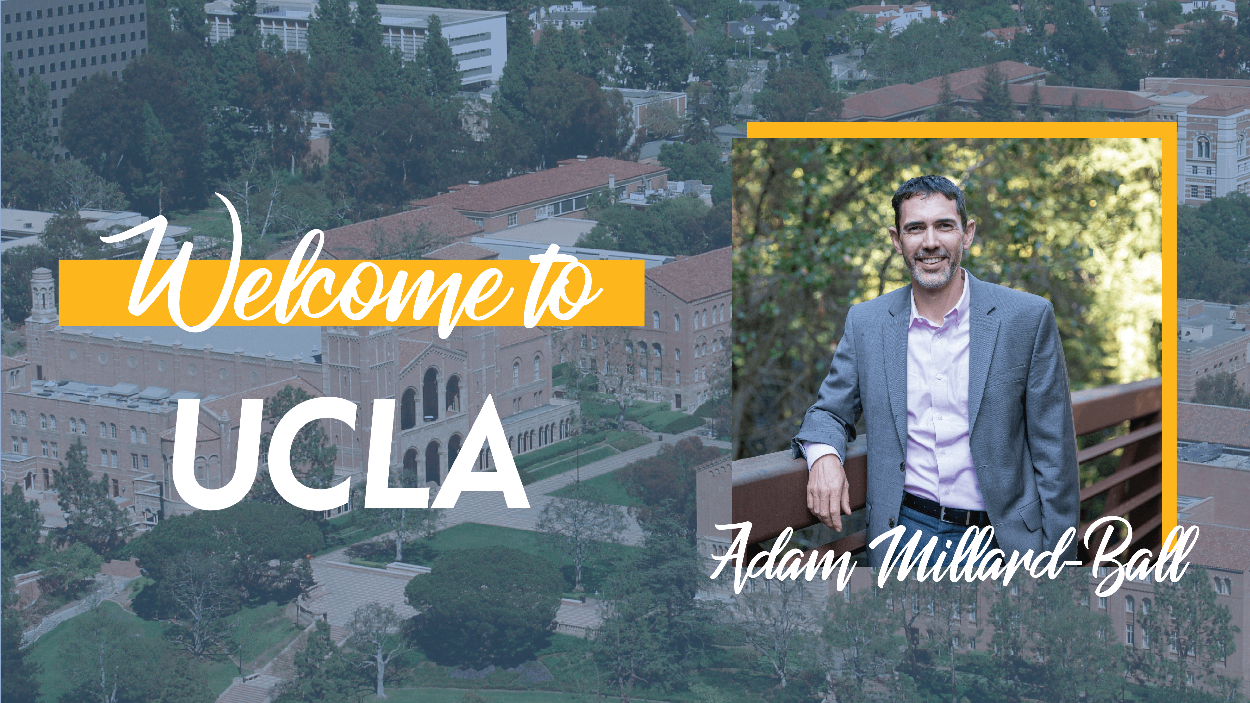
Q&A with urban planning professor Adam Millard-Ball
At the start of 2021, the UCLA Luskin School of Public Affairs welcomed a new faculty member. Adam Millard-Ball joins UCLA as an associate professor of urban planning and a member of the UCLA Institute of Transportation Studies research team. Our communications fellow and second-year MURP student, Lena Rogow, sat down with professor Millard-Ball to learn more about his background, his thoughts on data science in urban planning, and what he’s looking forward to about working at UCLA.
This interview has been edited for length and clarity.
Lena Rogow: Welcome to UCLA Luskin! We’re excited to have you here. Do you want to introduce yourself and tell us a bit more about your work and research focus?
Adam Millard-Ball: Thanks! I’m excited to be here. My background in transportation began not in academia but through working at a magazine in the U.K. called Local Transport Today. I then became more interested in transportation and the environment and worked as a planner at Nelson\Nygaard in San Francisco. In that role, I led a research project about carsharing, which led me to get a PhD.
My research focus now spans a couple of areas. My main project is a collaborative work with Chris Barrington-Leigh at McGill [University] measuring global sprawl through street connectivity. The more sprawling an area is, the less street connectivity it has. I’m also investigating transportation and climate policy and considering how transportation can be integrated into climate goals. Transportation is the fastest-growing source of greenhouse gas emissions in the world and my research looks into how we can make the industry more energy efficient.
LR: What specifically about “street connectivity” makes it a relevant research topic today?
AMB: My work about street connectivity is interesting because of the longevity of streets. Density and land use change over time, but streets are pretty much cemented in stone.
I’m especially interested in this focus area at a global scale. In the U.S., there is already a lot of work on this topic. However, there is limited research in other regions of the world. My work tells us which areas of the world have made the shift from being less connected to more connected in recent years. Our results can look beyond the cities that get the most press for being less sprawling, like Copenhagen. Cities in Argentina, Korea and Sudan also have some of the most connected networks that we analyzed. These findings are important because street connectivity can reduce greenhouse gas emissions. Our research can demonstrate the causes and consequences of travel behavior.
LR: What do you hope to bring to UCLA and how can UCLA benefit from your research goals?
AMB: One of the things I’m most drawn to at UCLA is being part of a larger enterprise with graduate students, faculty and research staff who are focused on transportation and the environment. UCLA is unparalleled in its breadth and depth of expertise in this field, and the range of interests among students and faculty. This role expands upon my past experience with undergraduates, and allows me to collaborate at a larger level with colleagues. I’m looking forward to being in person at UCLA where I can have more serendipitous conversations in the hallways while waiting to get lunch or collecting mail.
LR: What’s the future of data in urban planning?
AMB: Data science opens up the field of planning research in a couple of ways. The planning world has witnessed a host of new challenges, such as the effect of Airbnb on housing markets and how ridershare has impacted transportation. Data science gives an extra dimension to the investigations of these issues. What was previously a project in just one or two cities can be expanded in a much larger sample with data science. Researchers can access data sources online in cities they don’t live in.
However, as convenient as data are to access, they are not the full picture. GPS data, for example, disproportionately represents high-income people with navigation in their cars. One could’ve said the same about smart phones a few years ago. This distribution of technology is especially true when considering transportation in lower-income countries in the Global South.
Data science has evolved to take on the role GIS used to be. It’s become a core skill set for planners. Even if they don’t work in data science, they’ll have to understand what it can do and how to work with colleagues in that area. As a city planner, it’s essential to not have the wool pulled over your eyes by data science, and can see through any data science sales pitch.
LR: This all sounds exciting! What courses will you be teaching at UCLA?
AMB: Transportation and Environmental Issues right now and Urban Data Science in the spring. And I hope to be teaching undergraduate courses as well next academic year.

