
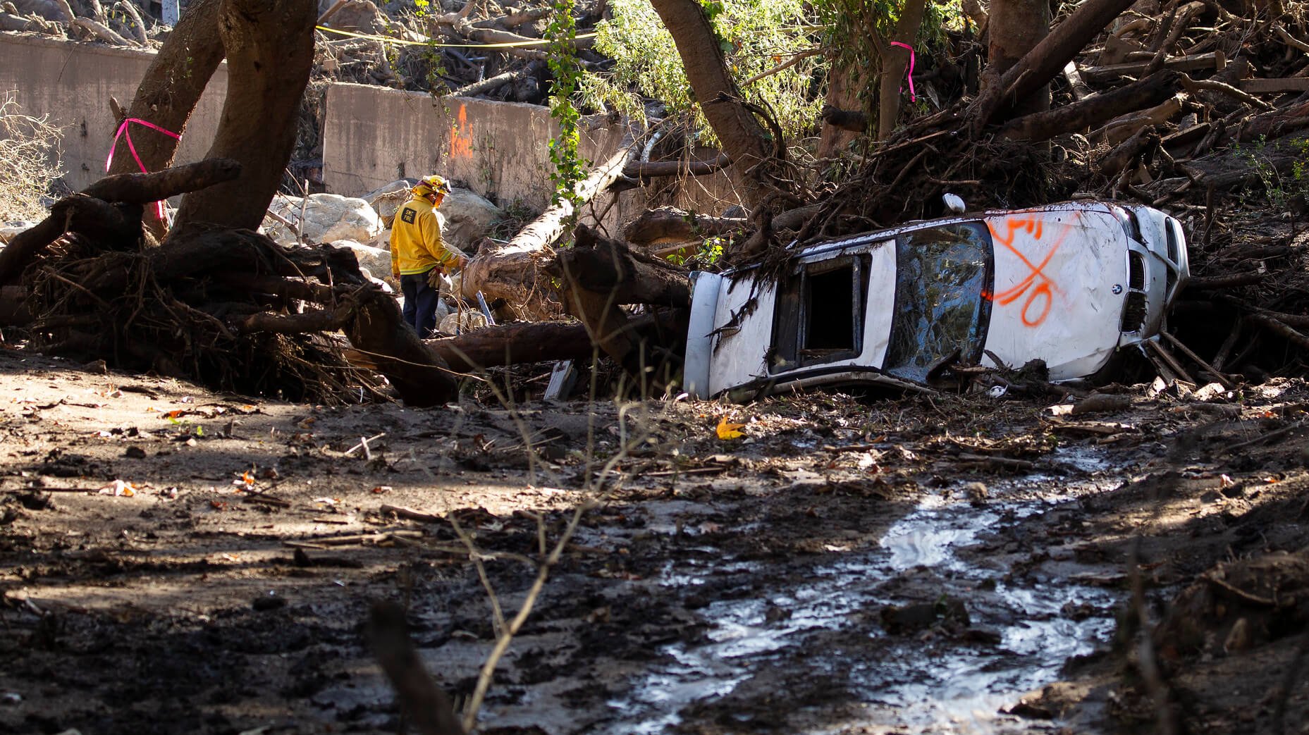
In the coming years, environmental events following wildfires can have long-lasting consequences for roadways, according to new research from UCLA. In particular, rainstorms can exacerbate wildfire damage and cause debris to accumulate on roads and, in extreme circumstances, cause them to collapse.
The report from Mikhail Chester, a climate adaptation expert who spent a year working as a visiting scholar with the UCLA Institute of Transportation Studies, investigated how climate change and wildfires will put many of California’s roadways at risk in the long run. In particular, Chester sought to fill gaps from past research about wildfires and transportation that only focused on the areas that immediately suffer from fire damage. Instead, his research focused on what makes surrounding roads vulnerable and how they may become more at risk after the fires.
“Fires change vegetation and soil chemistry. So when it eventually rains, it increases chances of landslides,” said Chester, an associate professor of civil and environmental engineering at Arizona State University. “What would have been pretty minor runoff turns into a major landslide event. Post-fire events can be hundreds to thousands of times more intense than if there hadn’t been a wildfire.” Some implications of this harm include roadway and other infrastructure washout, as well as blocking travelers from getting to their destinations — which can include evacuation routes or hospitals.
Chester developed a post-wildfire vulnerability assessment for the state of California, taking into account multiple factors like vegetation, soil composition, geologic conditions, hydrology, along with current and future predictions of rain and fire risk. Also considered was how critical the roads are (i.e., are they central to a network or can parallel roads also be used). An interactive map of the results can be found at wildfires.resilientinfrastructure.org.
When considering multiple future climate change scenarios, Chester said the results aren’t easily distributed across the state. In many places where risk is already high conditions become worse in the future. However, other places that are currently at low risk will see their vulnerability increase. This creates a challenge for state agencies as they’ll have to increase capacity in existing wildfire-prone regions, and ramp up capacity in other regions. The study identified mountainous regions, like the northwest near Oregon, and hilly places along the coastline from Malibu to Half Moon Bay as hotspots.
Because of this increased vulnerability, Chester said that instead of building based on a purely robustness-focused mindset, California should build its roadways with adaptability in mind. The state should protect roads where they can, but also expect and plan for failures, protecting life, ensuring safe access to hospitals and other critical services, and maintaining evacuation routes.
This is the second study Chester has conducted on roadway vulnerability post-wildfires. The first focused on the forested region of northern Arizona.
Chester said he’d love to expand the study to the whole Western United States. “Climate change transcends geopolitical boundaries. The West shares firefighters. These are state-specific issues. We all are in this together,” he said.
Photo source: Flickr/California National Guard
